Overview
- City: Washington, D.C. Metropolitan Area (including linked corridors in Baltimore, MD, and Northern Virginia)
- Assessment Period: June 19, 2026 – July 19, 2026
- Key Locations: Washington Union Station, Ronald Reagan Washington National Airport (DCA), Washington Dulles International Airport (IAD), Seagirt Marine Terminal, Baltimore/Washington International Thurgood Marshall Airport (BWI), Alexandria Station, CSX Cumberland Yard
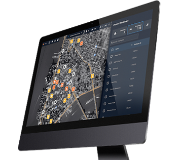
Make faster, data-driven decisions to protect people and infrastructure with Dataminr and Esri | Learn More
Executive Summary
Operational friction across the regional logistics network stems primarily from public gatherings, security breaches, and recurrent utility failures. The most immediate vulnerabilities are concentrated at critical intermodal hubs, where physical blockages, transit operator disruptions, and downed power lines compound existing structural grid stress. Public safety incidents, including targeted commercial theft near the maritime perimeter and urban rail connections, continue to draw down security enforcement resources and slow response times for freight and transit operations.
Coordinated tactical deployments are increasingly required to manage terminal disruptions and stabilize surrounding transit corridors. Perimeter incursions, such as unauthorized runway-bound pedestrian movement at aviation facilities and track trespassing within regional rail corridors, represent the highest-priority risk vectors.
Transportation & Infrastructure Analysis (Last 30 days)
Traffic & Highways
- Long Bridge Drive and GW Parkway (Arlington, VA): Repeated full road closures and persistent delays bottlenecked vehicle flow adjacent to major aviation assets.
- Lowman Street and McComas Street (Baltimore, MD): Frequent blockages and significant delays near the maritime perimeter disrupted commercial freight flow and local arterial access.
- Boundary Drive and Boundary Channel Drive (Arlington, VA): High-density traffic delays and temporary lane obstructions restricted access routes connecting to major state roadway systems.
Rail & Transit
- Washington Union Station: Public gatherings obstructed the main terminal entrance, while a shooting at H Street NE and 6th Street NE injured three people and forced police cordons and route diversions.
- East McComas Street and Andre Street (Baltimore, MD): A vehicle crash left a car stuck on active tracks, causing asset damage and halting regional freight and passenger rail movement.
- Ronald Reagan Washington National Airport Station: Track trespassing and switch failures caused significant multi-directional delays on Metrorail Blue and Yellow Line trains, halting transit across the corridor.
Aviation
- Washington Dulles International Airport: A critical baggage system failure at Washington Dulles Airport disrupted terminal operations, forcing ground authorities to delay multiple departing flights and implement contingency sorting protocols.
- Ronald Reagan Washington National Airport: Severe weather triggered ground stops that halted airfield operations, while concurrent mechanical failures on connecting transit lines isolated terminals from the regional rail network.
- BWI Airport: Weather-induced ground stops forced multiple flight diversions, straining terminal capacity and disrupting scheduled arrivals from domestic and international hubs.
Maritime
- Seagirt Marine Terminal: Medical emergencies aboard separate docked ships required specialized shoreside rescue teams and brief berth security containment.
- Boston Street and South East Avenue corridor: A high volume of public safety incidents, including multi-person altercations and commercial shoplifting, flanked the marine terminal perimeter and required sustained police intervention.
- Key Highway and East McComas Street: Standing water from flooding covered low-lying roadways servicing the maritime terminal; a separate flooding incident on Whetstone Way compounded logistical friction for commercial truck traffic in the same area.
Utilities
- 1500 Block of Dorsey Road (Glen Burnie, MD): Downed utility wires near BWI Airport caused localized grid stress and required emergency repairs.
- Washington Union Station: Two separate gas leaks (one at 5th Street NE and D Street NE, and another on the 400 block of F Street NE) prompted perimeter controls and disrupted pedestrian traffic within days of each other.
- Alexandria Station corridor: Rolling Dominion Energy outages cut power to more than 200 customers, temporarily disrupting utility baselines near the station.
Transportation & Infrastructure Analysis (Last 6 months)
DCA activity driven by routine operations: Activity at Ronald Reagan Washington National Airport (DCA) remained consistently high, accounting for roughly 40% of all monthly alerts between February and July. This volume reflects a steady concentration of incidents rather than event-driven spikes, primarily fueled by routine ground stops, delays, and ongoing flight-status updates.
Growth tracked closer to roadwork than to weather: construction-related alerts climbed from about 6% of monthly volume in February to roughly 13% by June, with the increase concentrated almost entirely at DCA. This trend reflected spring and summer roadwork along the GW Parkway/Long Bridge corridor rather than a security or weather-driven spike.
Traffic-delay alerts anchor the dataset throughout the period: they held between roughly 35–38% of total monthly volume system-wide every month from February through June, reinforcing that most alerting reflects everyday congestion rather than discrete incidents.
Ground stops rose, but gradually: from about 1–2% of monthly alerts in February–March to roughly 4–5% by June — a real but modest seasonal climb, notably smaller than the construction-driven increase above.
Key Infrastructure
Alexandria Station
Crashes on N. Lee St/near Gibbon St; rolling Dominion Energy outages; wildfire smoke.
Bus route/platform access delays; backup security reliance and maintenance delays; smoke limited track inspection windows.
BWI Airport
Weather-driven ground stops/diversions; downed wires and electrical emergency nearby; public safety incidents on Ferndale Road.
Cascading regional flight delays; lane closures for utility repairs; police pulled from patrols for medical calls.
CSX Cumberland Yard
First Energy outage hit 300+ customers; chlorine smell/smog raised industrial leak concerns.
Power loss delayed signaling and car sorting; shelter-in-place backed up freight transfers and limited yard access.
DCA Airport
Storms triggered ground stops; frequent closures on Long Bridge Dr/GW Parkway; Metrorail Blue/Yellow line disruptions.
Nationwide schedule disruption, gate oversaturation; road closures stranded traffic; Metrorail suspensions caused secondary highway gridlock.
IAD Airport
Critical baggage claim failure; absorbed diverted flights from regional storms; wildfire smoke reduced visibility.
Runway incursion halted departures; diversions filled gates, delaying baggage/turnaround; wider ATC separation cut arrival rates.
Seagirt Marine Terminal
Access-route delays (Lowman/McComas/Harbor Tunnel Thruway); rising perimeter public safety incidents; flooding and CO alarms nearby.
Flooding/congestion slowed truck turn times; incident response diverted maritime security; CO alarms and a crash halted rail/gate ops for hours.
Washington Union Station
Shooting at H St/6th St NE (3 injured); public gatherings at entrances; two gas leaks and brush fires nearby.
Cordons diverted buses and restricted access; public gatherings delayed rail ops/foot traffic; gas leaks/fires forced evacuations and schedule delays.
Cyber-Physical Spotlight
US Department of Energy and National Transportation Network Breaches: Multiple advanced threat groups executed high-impact cyber operations successfully penetrating the data repositories of federal energy laboratories and primary passenger transit infrastructure.
In a significant breach of federal research networks, an unauthorized threat actor infiltrated a U.S. Department of Energy database, claiming to have exfiltrated classified and highly confidential internal reports generated by its national laboratories.
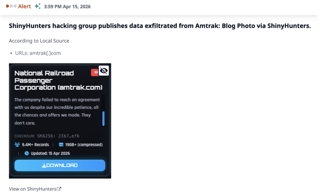
Simultaneously, commercial passenger rail network security was heavily compromised when a ShinyHunters-branded ransomware group targeted Amtrak’s network architecture, resulting in a severe data exfiltration incident that exposed over 9.4 million Salesforce records filled with customer personally identifiable information (PII) and proprietary internal corporate data. Further compounding the impact on national transportation metrics, an independent threat actor claimed a successful system breach of the Bureau of Transportation Statistics database, exfiltrating a massive dataset containing 20 million rows of sensitive, consumer-focused PII.
Priority Risk Indicators
- Coordinated air cargo and transit blockades: Monitor decentralized communication networks and physical staging patterns at terminal access gates to identify blockades before they disrupt freight and passenger flows.
- Infrastructure copper and cable theft: Map high-frequency target zones, repeat utility tampering, and commercial property public safety clusters near vulnerable rail switches and power substations.
- Risk profile: Rapidly detect localized public safety incidents, weapons possession, or deliberate physical obstruction within high-volume transit hubs to mitigate active-shooter or mass-casualty risk.
About the Risk Report
Dataminr is the global leader in AI-powered real-time intelligence, delivering the earliest actionable indicators of breaking events, emerging threats, and unexpected risks by leveraging 60+ specialized large language models (LLMs) and over 13 years of trusted historical data to instantly synthesize information from 1.2M+ publicly available data sources in 150+ languages across text, image, audio, video, and sensor data.
This report is an AI-powered retrospective risk assessment using data surfaced by the platform. The information illustrates the types of hyperlocal events and risks Dataminr detects in real-time. It is not a representation of Dataminr’s real-time intelligence products.
Turn Public Data into Action
Gain critical context and increase decision-making speed with AI-Powered Real-Time, Event, Threat & Risk Intelligence.
REQUEST A DEMO