
Overview
- City: Los Angeles, CA
- Assessment Period: June 19, 2026 – July 19, 2026
- Key Locations: Los Angeles Union Station, Los Angeles International Airport (LAX), Hollywood Burbank Airport (BUR), Port of Los Angeles, Port of Long Beach, Long Beach Airport (LGB), John Wayne Airport (SNA), SoFi Stadium.
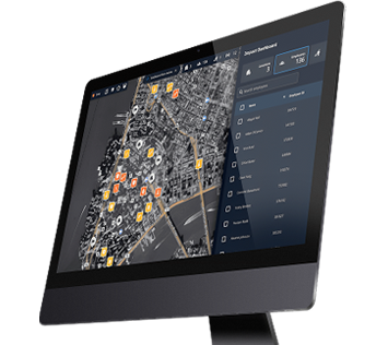
Make faster, data-driven decisions to protect people and infrastructure with Dataminr and Esri | Learn More
Executive Summary
The LA metropolitan transit network faced significant friction from recurring infrastructure failures, utility disruptions, and persistent public safety incidents near critical freight and aviation hubs. Frequent water main breaches and localized electrical outages adjacent to primary arterial roadways directly choked commercial traffic corridors, while localized public safety incidentes—specifically copper wire theft from electrical boxes and commercial vehicle break-ins—undermined physical security perimeters.
Residual transportation bottlenecks and transit strains from the FIFA World Cup 2026 tournament surges, heavily degraded standard traffic flows and transit corridor capacity across the stadium and rail sectors. Concurrently, public celebrations and high-density gatherings linked to America250 events injected sustained logistical pressure into major transit corridors.
Coordinated tactical interventions by regional law enforcement and municipal engineering crews were required to stabilize logistics operations at key maritime and aviation gateways. Rapid deployment protocols were repeatedly initiated in response to brush fires adjacent to airport highway corridors and rolling street takeovers that blocked arterial access roads.
Transportation & Infrastructure Analysis (Last 30 days)
Traffic & Highways
- FIFA World Cup road closures: Road closures obstructed massive segments of the 1000 block of South Stadium Drive and South Prairie Avenue between West 103rd Street and West 104th Street in Inglewood, severely bottlenecking stadium approach traffic.
- Tournament traffic protocols: Authorities closed surface streets on East Nutwood Street, East Hardy Street, and East Kelso Street between South Osage Avenue and South Prairie Avenue, forcing extensive commercial vehicle detours.
- Vehicle accident congestion: Severe vehicle accidents and structural hazards generated major delays near Donald Douglas Drive and California State Route 19 near Long Beach Airport, completely gridlocking access roads.
Aviation
- Airport perimeter fire: A major brush fire on July 11, 2026, generated heavy smoke plumes directly adjacent to the primary LAX highway corridor, severely reducing motorist visibility next to the airport highway and restricting landside access gates.
- Airspace pattern holding: Commercial flights encountered immediate holding patterns on June 22, 2026, en route to LAX, including Southwest Airlines Flight and American Airlines, due to tournament-induced airspace congestion.
- Tactical airfield response: An active airfield aircraft emergency reported on-site at a regional commercial runway layout triggered immediate ground flow restrictions and temporary flight delays.
Rail & Transit
- Transit sector strain: Tournament road closures on East Queen Street between North Eastwood Avenue and North Prairie Avenue forced massive rerouting of regional feeder buses near Union Station.
- Violent physical altercation: An altercation occurred on the Metro B Line platform on the 800 block of North Vignes Street at Union Station, disrupting passenger rail schedules and requiring police intervention.
- Operator disruption: An uncooperative individual refused to exit a municipal transit bus at the intersection of North Hill Street and West Cesar Estrada Chavez Avenue, halting the line.
Maritime
- Supply chain volatility: Twelve cargo and tanker vessels were forced into extended anchorage queues outside the Ports of Los Angeles and Long Beach.
- Water rescue operation: An emergency response was initiated on the 350 block of East Shoreline Drive near the Port of Long Beach, temporarily halting local maritime traffic and diverting surface vessels.
- Perimeter security breach: Security responses were triggered on the 420 block of West 22nd Street near the Port of Los Angeles after three suspects breached vehicle perimeters and fled into adjacent industrial zones.
Utilities
- Copper wire theft: Targeted theft caused significant damage to an electrical box at the intersection of South Sepulveda Boulevard and West Manchester Avenue, degrading localized utility reliability.
- Major water main break: Disrupted municipal services flooded nearby surface streets in the Hollywood area, forcing the Los Angeles Department of Water and Power to execute emergency shutoffs.
- Natural gas leak: A critical leak prompted emergency isolation protocols on the 6320 block of West 85th Place in Westchester, forcing localized area closures near major transport corridors.
Transportation & Infrastructure Analysis (Last 6 months)
Maritime Sector Security Risks: Security assessments highlight a major upward trend at critical port infrastructure, driven by a 105% surge in public safety incidents around the Port of Los Angeles between April and June.
Port of Long Beach Operational Stabilization: Security and traffic monitoring at the Port of Long Beach recorded a 37% reduction in transit-related incidents between April and May.
Union Station FIFA Fan Zone Operations: Transit telemetry identified an upward spike in perimeter traffic restrictions and infrastructure strain surrounding Union Station, exhibiting a 23% increase in transit-impact alerts from May to June as the official World Cup Fan Zone activation took effect along North Alameda Street.
Key Infrastructure
BUR Airport
Trespasser on Metrolink tracks; vehicle crash disrupted landside approach; brush fire reduced visibility.
Rail slow-orders from track incursions; landside access delays; minor air traffic adjustments from reduced visibility.
LAX Airport
Ongoing vehicle theft near airport; vehicle fire caused traffic blockage; trespassing at nearby lodging facility.
Heightened cargo/rental-car theft risk; Century Blvd congestion delaying passenger transport; stricter aircraft holding patterns.
LGB Airport
Traffic delays on nearby roads; erratic behavior reported at a gas station; power outage affected 100+ SoCal Edison customers.
Secondary gridlock at 29th/Temple; landside friction causing minor flight/passenger delays; localized grid stress.
Port of Long Beach
Broader San Pedro Bay anchorage backlog; brush fire near port access route; armed individual reported nearby.
Fire response throttled Route 710 freight access; anchorage backlog delays container processing; truck rerouting from event closures.
Port of Los Angeles
Vessel processing delays from ship backlog; shooting incident in San Pedro; construction-related closures.
Construction bottlenecked heavy vehicle access; police cordons briefly restricted truck movement; rail transfer scheduling friction.
SNA Airport
Active aircraft emergency; localized flooding near perimeter; multiple collisions nearby.
Runway restrictions caused diversions/delays; flooding limited freight corridor access; congestion slowed passenger distribution.
SoFi Stadium
Heavy traffic from FIFA World Cup matches and nearby events; gas leak; multiple collisions nearby.
Gas leak triggered diversions and lane closures; prolonged gridlock slowing regional bus lines.
Union Station
Weapon assault and armed suspect alerts nearby; reckless driving near Alameda/Temple; event road closures; Summit Fire evacuations.
Platform altercations caused minor Metro delays; shuttle bus disruptions; commercial traffic detoured from Alameda corridor.
Cyber-Physical Spotlight
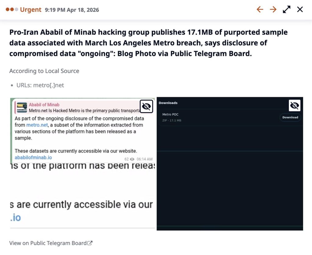
LA Metro Cyberattack: Pro-Iranian threat actor Ababil of Minab claimed responsibility for a cyberattack against the Los Angeles County Metropolitan Transportation Authority (LACMTA), alleging administrative access to virtualization infrastructure, web servers, and an operational rail yard management system, alongside claims of 500 TB of data destruction and 1 TB of sensitive data exfiltration.
Read the full story behind the Cyber-Physical Spotlight here.
Priority Risk Indicators
- Critical Maritime and Intermodal Supply Chain Bottlenecks: Security and logistics teams must monitor vessel anchorage queues and access corridors around the Ports of Los Angeles and Long Beach, where a 105% surge in local port-adjacent public safety incidents and Route 710 highway fire blockades risk cascading regional freight delays.
- Aviation Landside Hazard Vectors: Operations should track dual landside risks along the LAX and Burbank highway corridors, where brush fires near major freeways directly reduce driver visibility and trigger immediate landside access gate restrictions.
- Transit Electrical and Utility Infrastructure Tampering: Security teams should increase monitoring of high-frequency target zones near transit electrical boxes, specifically at South Sepulveda Boulevard and West Manchester Avenue, where copper wire theft directly degrades localized signaling and grid reliability.
- Hub Security and Platform Altercations: Physical security protocols must be reinforced along the Metro B Line platform and the 800 block of North Alameda Street at Union Station, where altercations and armed suspect alerts repeatedly trigger rail line delays and passenger shuttle unavailability.
About the Risk Report
Dataminr is the global leader in AI-powered real-time intelligence, delivering the earliest actionable indicators of breaking events, emerging threats, and unexpected risks by leveraging 60+ specialized large language models (LLMs) and over 13 years of trusted historical data to instantly synthesize information from 1.2M+ publicly available data sources in 150+ languages across text, image, audio, video, and sensor data.
This report is an AI-powered retrospective risk assessment using data surfaced by the platform. The information illustrates the types of hyperlocal events and risks Dataminr detects in real-time. It is not a representation of Dataminr’s real-time intelligence products.
Turn Public Data into Action
Gain critical context and increase decision-making speed with AI-Powered Real-Time, Event, Threat & Risk Intelligence.
REQUEST A DEMO