Elevate Situational Awareness with Geographic Context
Dataminr and Esri provide AI-powered real-time event, threat, and risk intelligence within the world’s leading spatial analytics platform. Make faster, data-driven decisions to protect people and infrastructure.
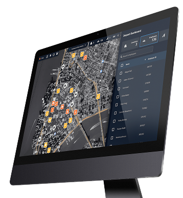
End Fragmentation: Your Common Operating Picture
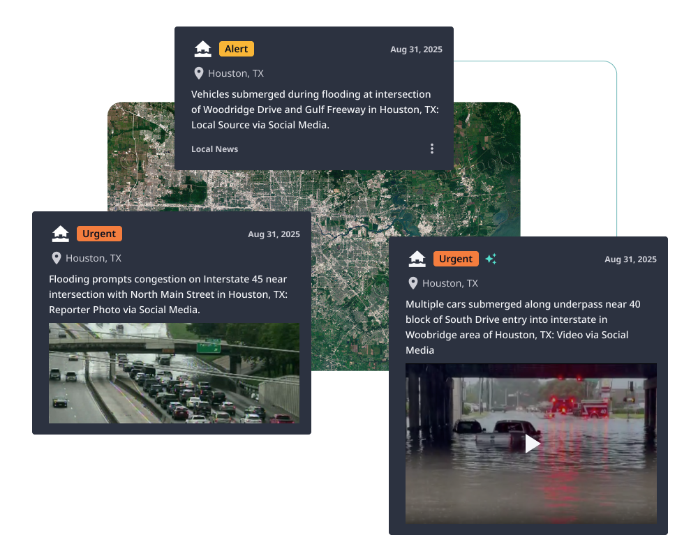
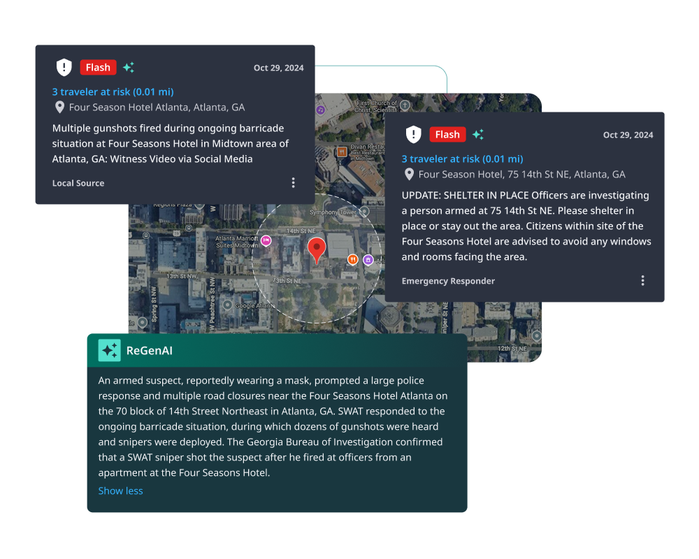
Critical minutes are lost relying on traditional sources. Disparate systems create fragmented information. Dataminr and Esri deliver a unified view by instantly visualizing AI-powered real-time event, threat, and risk intelligence within your ArcGIS environment, giving you the early warning advantage needed for coordinated, proactive response.

Early Warning Enables Effective Response
Combining Dataminr’s groundbreaking AI with Esri’s world-leading GIS mapping software empowers organizations with unprecedented decision-making capabilities informed by critical emerging events and advanced geospatial awareness

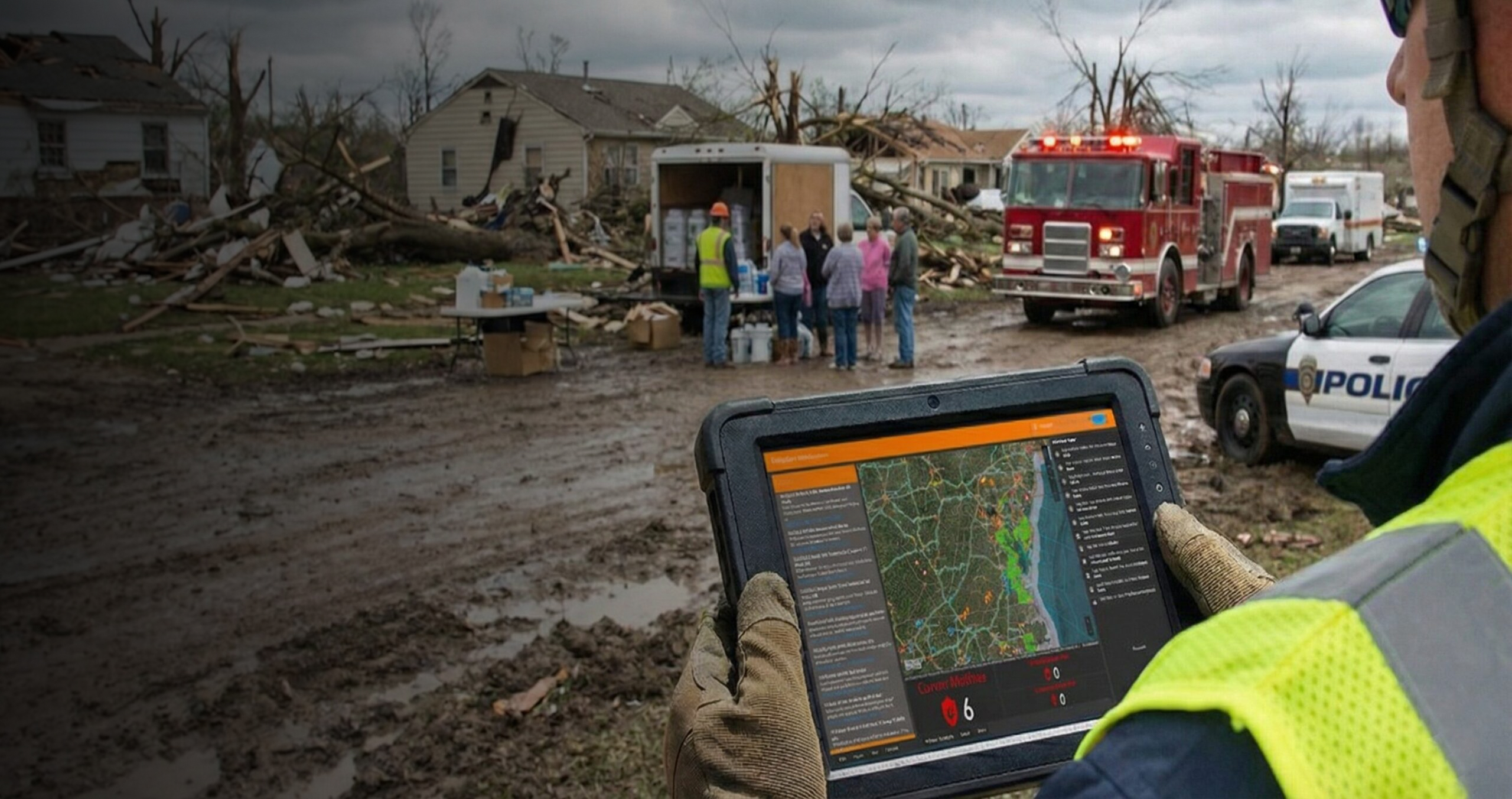
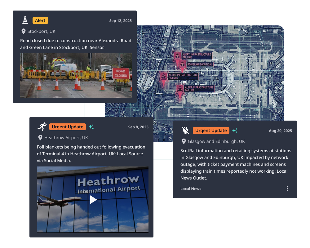
Emergency Management & Crisis Response
Improve decision-making during a disaster. Use early detection, visualization of critical infrastructure impact, and a unified operating picture.
Public Safety
Enhance situational awareness during major events by receiving real-time alerts on incidents that could affect people’s safety, helping protect both the public and field personnel.
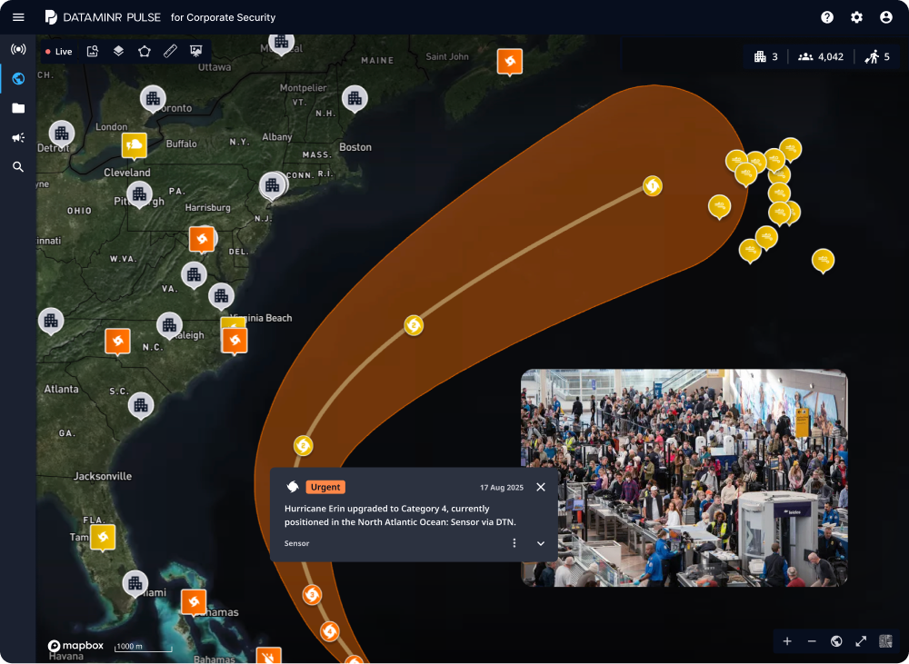
Transportation & Infrastructure Protection
Detect disruptions earlier and implement alternative routing to minimize downtime and protect critical infrastructure.
Traveler Safety
Identify hyperlocal events affecting travelers. Monitor itineraries based on location to enable proactive security measures before threats escalate.
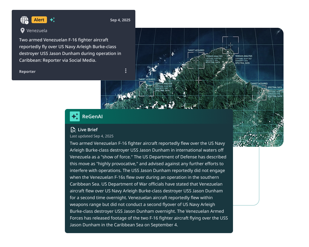
Force Protection
Monitor risks to personnel and facilities worldwide by visualizing multiple security vectors simultaneously.
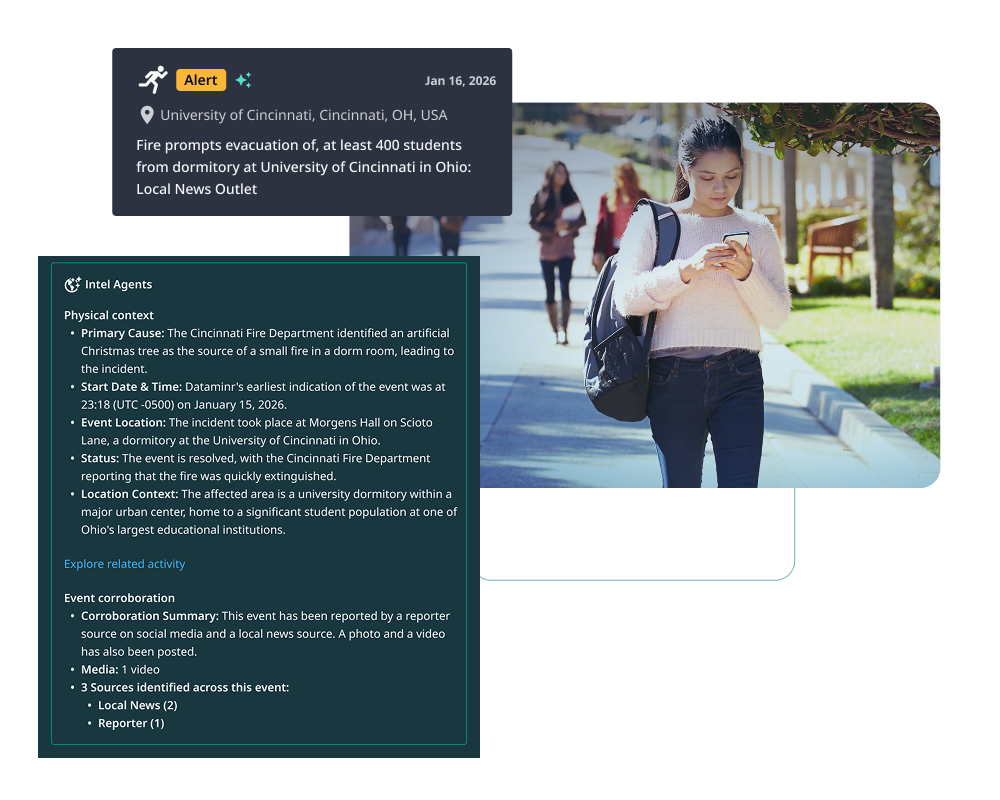
Campus Security Operations
Improve safety and coordination. Monitor incidents across distributed campus environments to enable faster, more efficient response efforts.
Featured Resources
Dataminr and Esri together give you real-time visibility, enabling you to move from static mapping to dynamic situational awareness across every location you monitor.
Solutions Sheet
Respond Faster with AI Alerts and the Power of Location
Minutes matter when emergencies or disruptions strike. To act effectively, organizations need early warnings combined with the geographic context to make rapid, informed decisions and direct resources with speed and precision.

Video
Your Maps. Your Real-Time Data. Your Agents — Finally Working Together.
At a recent event, Dataminr VP of Product Management Andy Rudd showed how Dataminr’s AI-powered, real-time event, threat, and risk intelligence can be embedded directly within the Esri environment — and how AI agents can coordinate across systems using Model Context Protocols (MCPs) to help emergency management teams surface, assess, and act on emerging threats with far less manual intervention.

Blog
How Dataminr and Esri Revolutionize Major Event Security
Explore how event organizers can benefit from the partnership between Dataminr and Esri, leaders in AI-powered real-time risk detection and geospatial mapping technology.