Security Operations, Public sector

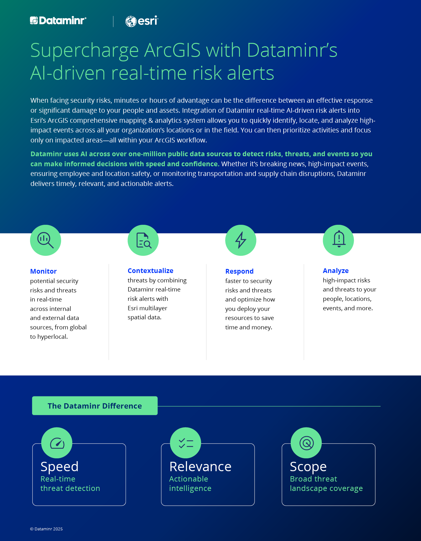
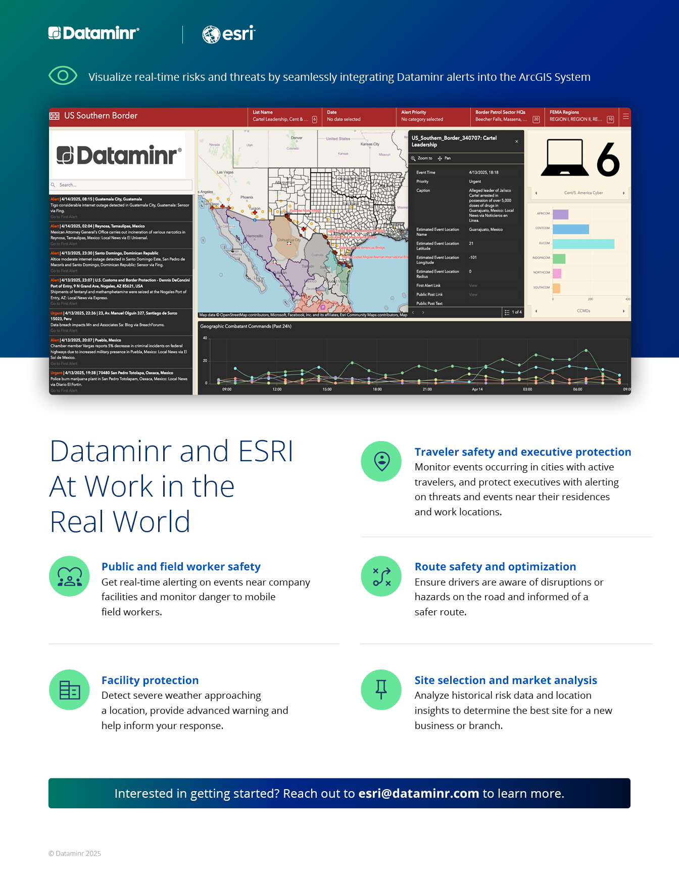
When facing security risks, minutes or hours of advantage can be the difference between an effective response and significant damage to your people and assets. Integrated with Esri’s ArcGIS comprehensive mapping and analytics system, Dataminr’s real-time AI-driven risk alerts enable you to quickly identify, locate and analyze high-impact events across your organization’s footprint.

Dataminr real-time AI-driven risk alerts integrated into Esri’s ArcGIS comprehensive mapping and analytics system allow you to quickly identify, locate, and analyze high-impact events across your organization’s footprint.
A vector image of planet Earth.
Solution Sheet

Enhance Your Travel Risk Management

Learn more about how Dataminr uses AI across over one million public data sources to detect risks, threats, and events, so you can make informed decisions with speed and confidence. At the same time, Esri provides comprehensive mapping and analytics to provide context and aid situational awareness.

DOWNLOAD
May 5, 2025
  • Security Operations
  • Public sector
  • Corporate Security
  • Public Sector
Case Study

Dataminr in Action ReGenAI: Cyclone Alfred

Cyclone Alfred made landfall in Australia's Northern Territory, bringing heavy rainfall, damaging winds, and widespread flooding. Dataminr enables clients to track the cyclone in real-time, receiving early alerts on landfall timing, road closures, and regional impacts.

Insight

How Dataminr and Esri Revolutionize Major Event Security

Explore how event organizers can benefit from the partnership between Dataminr and Esri, leaders in AI-powered real-time risk detection and geospatial mapping technology.